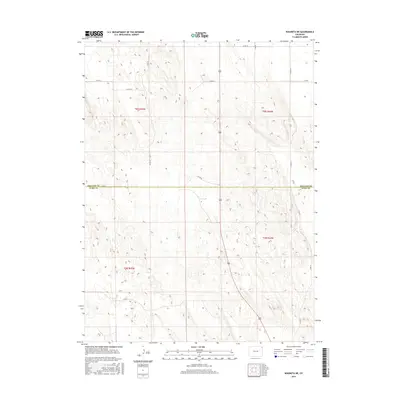
2016 Map of Wauneta NE
USGS Topo · Published 2016About this map
The Phillips Co Yuma Co boundary divides this high plains landscape, where the Jeffersonian grid system defines nearly every aspect of the modern terrain. This 2016 survey highlights a remote agricultural region organized into townships such as t6n r45w and t5n r44w, where section lines are preserved by a network of gravel roads including Co Rd 8 and Co Rd 2. The subtle relief of the land is traced by contour lines that reveal the gentle drainage patterns of the eastern Colorado plateau. Local transport is entirely dependent on this rectilinear grid, with routes like Co Rd FF and Co Rd 60 providing the primary access between isolated farmsteads and the vast open acreage. The map serves as a precise record of the administrative and physical geography of the Colorado borderlands in the early 21st century.
Find a feature on this map
15 named features on this map. Tap any name to fly to it.
Don’t see what you’re looking for? This feature index may not catch every label — zoom into the map to look around manually.
Map Details
Editions of this 2016 Wauneta NE Map
This is the sole edition of this map. No revisions or reprints were ever made.
Other maps of this area

1954 · Sterling
USGS Topo · 1:250,000

1958 · Sterling
USGS Topo · 1:250,000

1971 · Paoli
USGS Topo · 1:24,000

1971 · Amherst SW
USGS Topo · 1:24,000

1971 · Holyoke
USGS Topo · 1:24,000

1971 · Alvin NW
USGS Topo · 1:24,000

1971 · Alvin SW
USGS Topo · 1:24,000

1971 · Fiddler Peak
USGS Topo · 1:24,000

1971 · Wauneta NE
USGS Topo · 1:24,000

1971 · Wauneta
USGS Topo · 1:24,000