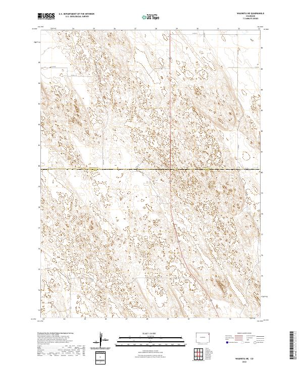
2022 Map of Wauneta NE
USGS Topo · Published 2022About this map
The boundary between Phillips Co and Yuma Co bisects this High Plains landscape, where a rigid grid of section lines and county roads imposes order on the undulating terrain of Northeast Colorado. Captured in 2022, the survey shows a territory primarily defined by its agricultural layout, with long thoroughfares like Co Rd 8 and Co Rd 10 stretching across the northern reaches of the quadrangle.
Find a feature on this map
16 named features on this map. Tap any name to fly to it.
Don’t see what you’re looking for? This feature index may not catch every label — zoom into the map to look around manually.
Map Details
Editions of this 2022 Wauneta NE Map
This is the sole edition of this map. No revisions or reprints were ever made.
Other maps of this area

1954 · Sterling
USGS Topo · 1:250,000

1958 · Sterling
USGS Topo · 1:250,000

1971 · Paoli
USGS Topo · 1:24,000

1971 · Amherst SW
USGS Topo · 1:24,000

1971 · Holyoke
USGS Topo · 1:24,000

1971 · Alvin NW
USGS Topo · 1:24,000

1971 · Alvin SW
USGS Topo · 1:24,000

1971 · Fiddler Peak
USGS Topo · 1:24,000

1971 · Wauneta NE
USGS Topo · 1:24,000

1971 · Wauneta
USGS Topo · 1:24,000