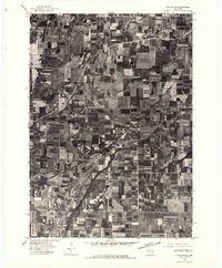
1975 Map of Waupun NE
USGS Topo · Published 1977About this map
Oakfield and the surrounding agricultural landscape of Fond du Lac County are captured in this orthophotograph based on aerial imagery from September 1975. The high-altitude perspective emphasizes the rigid grid of Wisconsin farm plots and drainage patterns, with the town of Oakfield serving as a primary hub. Further north, the small settlement of Lamartine appears along the roadway network, while Oak Center sits to the west, illustrating the dense distribution of rural communities in this era.
Find a feature on this map
4 named features on this map. Tap any name to fly to it.
Don’t see what you’re looking for? This feature index may not catch every label — zoom into the map to look around manually.
Map Details
Editions of this 1975 Waupun NE Map
This is the sole edition of this map. No revisions or reprints were ever made.
Other maps of this area

1910 · Fond du Lac
USGS Topo · 1:62,500

1955 · Waupun
USGS Topo · 1:62,500

1955 · Campbellsport
USGS Topo · 1:62,500

1955 · Fond Du Lac
USGS Topo · 1:62,500

1955 · Fond Du Lac
USGS Topo · 1:24,000

1956 · Rosendale
USGS Topo · 1:62,500

1957 · Madison
USGS Topo · 1:250,000

1960 · Madison
USGS Topo · 1:250,000
1974 · Byron
USGS Topo · 1:24,000
1974 · Lomira
USGS Topo · 1:24,000