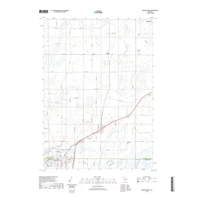
2018 Map of Waupun North
USGS Topo · Published 2018About this map
Waupun straddles the county line between Fond du Lac and Dodge counties, anchoring a landscape defined by the winding branches of the Rock River. The northern outskirts of the city reveal a concentration of civic and community landmarks, including Juniper Hill and the Forest Mound Cem. A notable geographic insight is found just south of the main settlement at the State Prison Cem, a site reflecting the long-standing institutional history of the area.
Find a feature on this map
94 named features on this map. Tap any name to fly to it.
Don’t see what you’re looking for? This feature index may not catch every label — zoom into the map to look around manually.
Map Details
Editions of this 2018 Waupun North Map
This is the sole edition of this map. No revisions or reprints were ever made.
Other maps of this area

1916 · Ripon
USGS Topo · 1:48,000

1918 · Ripon
USGS Topo · 1:62,500

1955 · Waupun
USGS Topo · 1:62,500

1955 · Fox Lake
USGS Topo · 1:62,500

1956 · Ripon
USGS Topo · 1:62,500

1956 · Rosendale
USGS Topo · 1:62,500

1957 · Madison
USGS Topo · 1:250,000

1960 · Madison
USGS Topo · 1:250,000

1975 · Waupun NW
USGS Topo · 1:24,000
1975 · Waupun NE
USGS Topo · 1:24,000