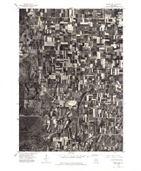
1975 Map of Waupun SE
USGS Topo · Published 1977About this map
Horicon Marsh dominates the western landscape of this 1975 aerial study, showing the extensive wetlands and conservation boundaries of the Horicon National Wildlife Refuge and the Horicon Marsh Wildlife Area. The orthophotograph reveals the tight-knit agricultural grid that defines this portion of Dodge County, where family farms are partitioned into a mosaic of cultivated fields. In the southeast corner, the Rock River serves as the focal point for the settlement of Mayville, which grew around the river's water power in the mid-19th century. Further north and west, the smaller crossroads of Leroy and Kekoskee appear as concentrated hubs of rural life. This overhead perspective preserves the exact footprint of these communities and their relationship to the marshlands during the mid-1970s, capturing the transition between protected wildlife habitats and intensive dairyland farming.
Find a feature on this map
6 named features on this map. Tap any name to fly to it.
Don’t see what you’re looking for? This feature index may not catch every label — zoom into the map to look around manually.
Map Details
Editions of this 1975 Waupun SE Map
This is the sole edition of this map. No revisions or reprints were ever made.
Other maps of this area

1904 · Hartford
USGS Topo · 1:62,500

1955 · Waupun
USGS Topo · 1:62,500

1955 · Campbellsport
USGS Topo · 1:62,500

1955 · Horicon
USGS Topo · 1:62,500

1957 · Madison
USGS Topo · 1:250,000

1959 · Hartford
USGS Topo · 1:62,500

1959 · Nenno
USGS Topo · 1:24,000

1960 · Madison
USGS Topo · 1:250,000
1974 · Byron
USGS Topo · 1:24,000
1974 · Lomira
USGS Topo · 1:24,000