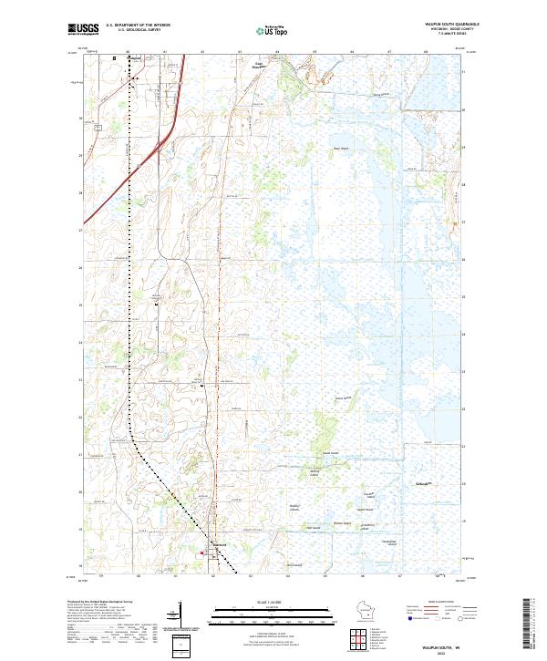
2022 Map of Waupun South
USGS Topo · Published 2022About this map
The vast wetlands of the Horicon Marsh dominate this landscape, where intricate waterways like Plum Creek and the West Branch Rock River wind through a complex system of islands and man-made ditches. Small settlements such as Burnett and Kekoskee sit on the margins of this aquatic ecosystem, connected by the Wild Goose State Trl which follows a historic corridor through the marshes. Local heritage is preserved in sites like the Burnett Union Cem and Atwater Community Cem, while the northern edge transition into the residential and commercial streets of East Waupun. This area is defined by its extensive drainage infrastructure, including the Sommers Ditch and Clarks Ditch, which manage the flow between the Burnett Flowage and the surrounding farmland. Numerous named landforms like Goose Island and Strawberry Island rise above the marshy terrain, offering a look at the natural geography of Dodge County.
Find a feature on this map
80 named features on this map. Tap any name to fly to it.
Don’t see what you’re looking for? This feature index may not catch every label — zoom into the map to look around manually.
Map Details
Editions of this 2022 Waupun South Map
This is the sole edition of this map. No revisions or reprints were ever made.
Other maps of this area

1955 · Beaver Dam
USGS Topo · 1:62,500

1955 · Waupun
USGS Topo · 1:62,500

1955 · Fox Lake
USGS Topo · 1:62,500

1955 · Horicon
USGS Topo · 1:62,500

1957 · Madison
USGS Topo · 1:250,000

1960 · Madison
USGS Topo · 1:250,000

1975 · Horicon NW
USGS Topo · 1:24,000

1975 · Beaver Dam NE
USGS Topo · 1:24,000

1975 · Waupun NW
USGS Topo · 1:24,000
1975 · Horicon NE
USGS Topo · 1:24,000