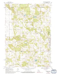
1968 Map of Wautoma
USGS Topo · Published 1992About this map
Wild Rose and the Wild Rose State Fish Hatchery anchor the eastern edge of this landscape, where the Pine River and Wild Rose Pond reflect the region's aquatic character. The area is defined by a dense concentration of cemeteries, including Bohemian Cem, Thomas Cem, Staples Cem, and Union Cem, providing a significant record for genealogical research in Waushara and Portage Counties. The Chicago and North Western railroad cuts diagonally across the northern townships of Almon and Belmont, passing near the small settlement of Heffron. In the southern half, the terrain transitions into the lake-strewn landscape of Chain Lake, Lake Wautoma, and Beans Lake. This survey preserves the rural network of named roads like Akron Drive and Apache Ave alongside local landmarks such as West Holden Ch and Mt Pleasant Cem.
Find a feature on this map
37 named features on this map. Tap any name to fly to it.
Don’t see what you’re looking for? This feature index may not catch every label — zoom into the map to look around manually.
Map Details
Editions of this 1968 Wautoma Map
2 editions found
Other maps of this area

1955 · Green Bay
USGS Topo · 1:250,000

1957 · Amherst
USGS Topo · 1:48,000

1957 · Waupaca
USGS Topo · 1:48,000

1959 · Wautoma
USGS Topo · 1:48,000

1961 · Redgranite
USGS Topo · 1:62,500

1961 · Wild Rose
USGS Topo · 1:24,000

1961 · Spring Lake
USGS Topo · 1:24,000

1968 · Richford
USGS Topo · 1:24,000

1968 · Plainfield
USGS Topo · 1:24,000
1968 · Wautoma
USGS Topo · 1:24,000