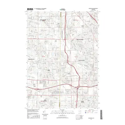
2015 Map of Wauwatosa
USGS Topo · Published 2015About this map
The Menomonee River and its tributaries, including the Little Menomonee River and Underwood Cr, carve through this densely developed corridor between Milwaukee and its western suburbs. The 2015 landscape is defined by its educational and medical institutions, featuring the Medical Coll of Wisconsin and Mt Mary Coll in Wauwatosa. Large cemetery grounds like Wisconsin Memorial Park Cem and Pinelawn Memorial Park Cem occupy significant acreage, providing open green spaces amidst the suburban grid of Brookfield and Elm Grove.
Find a feature on this map
48 named features on this map. Tap any name to fly to it.
Don’t see what you’re looking for? This feature index may not catch every label — zoom into the map to look around manually.
Map Details
Editions of this 2015 Wauwatosa Map
This is the sole edition of this map. No revisions or reprints were ever made.
Other maps of this area

1891 · Bayview
USGS Topo · 1:62,500

1891 · Muskego
USGS Topo · 1:62,500

1892 · Milwaukee
USGS Topo · 1:62,500

1892 · Waukesha
USGS Topo · 1:62,500

1901 · Milwaukee
USGS Topo · 1:62,500

1901 · Waukesha
USGS Topo · 1:62,500

1901 · Bayview
USGS Topo · 1:62,500

1901 · Muskego
USGS Topo · 1:62,500

1906 · Waukesha
USGS Topo · 1:62,500

1906 · Milwaukee
USGS Topo · 1:62,500