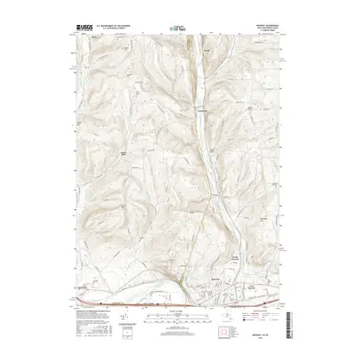
2016 Map of Waverly
USGS Topo · Published 2016About this map
The Chemung River valley defines the southern boundary of this region, where the border between Chemung County and Tioga County meets the Pennsylvania state line. The landscape is characterized by a series of prominent ridges, including Porter Hill, Bogart Hill, and Tallmadge Hill, which overlook a network of narrow creek valleys. Along the eastern edge, Cayuta Creek carves a significant corridor that supports the village of Lockwood and the northern outskirts of Waverly. This 2016 survey documents a high density of burial sites and family landmarks, such as the Price-Simcoe Cem, Hicks Cem, and the settlement at Owens Mills. The infrastructure of North Waverly and East Waverly reflects a transition from the river-bottom industry near Chemung to the upland agricultural character found along Dry Brook and Mallory Creek.
Find a feature on this map
132 named features on this map. Tap any name to fly to it.
Don’t see what you’re looking for? This feature index may not catch every label — zoom into the map to look around manually.
Map Details
Editions of this 2016 Waverly Map
This is the sole edition of this map. No revisions or reprints were ever made.
Other maps of this area

1902 · Waverly
USGS Topo · 1:62,500

1903 · Owego
USGS Topo · 1:62,500

1905 · Watkins Glen
USGS Topo · 1:125,000

1906 · Catatonk
USGS Topo · 1:125,000

1923 · Towanda
USGS Topo · 1:62,500

1926 · Towanda
USGS Topo · 1:62,500

1939 · Sayre
USGS Topo · 1:62,500

1942 · Sayre
USGS Topo · 1:62,500

1943 · Towanda
USGS Topo · 1:62,500

1948 · Sayre
USGS Topo · 1:62,500