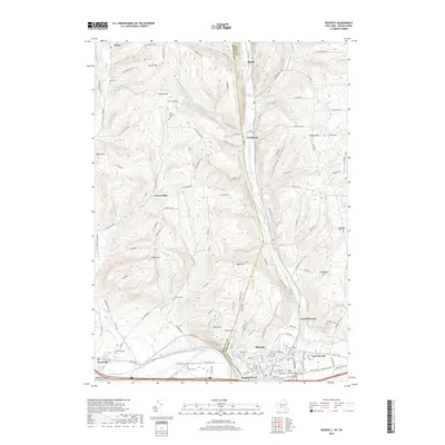
2019 Map of Waverly
USGS Topo · Published 2019About this map
Cayuta Creek flows southward through a deep valley, guiding the transit corridor for the community of Lockwood and the larger settlement of Waverly. The landscape is defined by its dramatic relief, where summits like Maple Hill, Porter Hill, and Tallmadge Hill rise sharply above the Chemung River and its fertile Chemung Valley. This 2019 survey documents a region where historic burial grounds are remarkably dense, preserving local lineage at sites such as Glenwood Cem, Forest Home Cem, and the Saint James Roman Catholic Cem. Small outlying hamlets including Hicks and Reniff remain nestled in the upland ridges, while the drainage of Dry Brook and Wynkoop Creek cuts through the western hills. The network of winding rural roads, such as Simcoe Hill Road and Miller Hollow Road, suggests a pattern of development shaped by the challenging terrain of the New York and Pennsylvania borderlands.
Find a feature on this map
125 named features on this map. Tap any name to fly to it.
Don’t see what you’re looking for? This feature index may not catch every label — zoom into the map to look around manually.
Map Details
Editions of this 2019 Waverly Map
This is the sole edition of this map. No revisions or reprints were ever made.
Other maps of this area

1902 · Waverly
USGS Topo · 1:62,500

1903 · Owego
USGS Topo · 1:62,500

1905 · Watkins Glen
USGS Topo · 1:125,000

1906 · Catatonk
USGS Topo · 1:125,000

1923 · Towanda
USGS Topo · 1:62,500

1926 · Towanda
USGS Topo · 1:62,500

1939 · Sayre
USGS Topo · 1:62,500

1942 · Sayre
USGS Topo · 1:62,500

1943 · Towanda
USGS Topo · 1:62,500

1948 · Sayre
USGS Topo · 1:62,500