
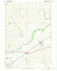
1964 Map of Waverly
USGS Topo · Published 1965About this map
Salt Creek winds through the heart of this landscape, its serpentine path defining the drainage for numerous tributaries like Rock Creek, Jordan Creek, and Stevens Creek. The topography is characterized by the distinct elevation of North Bluff and the rolling agricultural land of Lancaster County during the mid-1960s. The town of Waverly sits as a primary hub of activity, positioned along the vital transportation corridor of the Chicago Burlington and Quincy railroad and the Quincy road.
Find a feature on this map
18 named features on this map. Tap any name to fly to it.
Don’t see what you’re looking for? This feature index may not catch every label — zoom into the map to look around manually.
Map Details
Editions of this 1964 Waverly Map
2 editions found
Other maps of this area

1893 · Fremont
USGS Topo · 1:125,000

1896 · Fremont
USGS Topo · 1:125,000

1897 · Lincoln
USGS Topo · 1:125,000

1899 · Wahoo
USGS Topo · 1:125,000

1903 · Weeping Water
USGS Topo · 1:125,000

1929 · Weeping Water
USGS Topo · 1:125,000

1955 · Fremont
USGS Topo · 1:250,000

1955 · Lincoln
USGS Topo · 1:250,000

1957 · Fremont
USGS Topo · 1:250,000

1957 · Lincoln
USGS Topo · 1:250,000