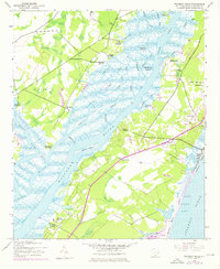
1942 Map of Waverly Mills
USGS Topo · Published 1976About this map
Waverly Mills and its surrounding rice-growing history are preserved in this 1942 topographical survey of the Waccamaw Neck. The landscape is defined by the convergence of the Pee Dee River, Waccamaw River, and Black River, creating a complex network of wetlands and tidal creeks like Jericho Creek and Carr Creek. The map documents a significant concentration of historic estates along the riverbanks, including Arundel Plantation, Hagley Plantation, and Darlington Plantation, many of which transitioned from agricultural powerhouses to private retreats by the mid-20th century.
Find a feature on this map
46 named features on this map. Tap any name to fly to it.
Don’t see what you’re looking for? This feature index may not catch every label — zoom into the map to look around manually.
Map Details
Editions of this 1942 Waverly Mills Map
3 editions found
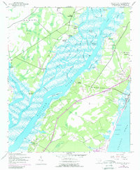
Other maps of this area

1942 · North Island
USGS Topo · 1:24,000

1942 · Magnolia Beach
USGS Topo · 1:24,000

1942 · Waverly Mills
USGS Topo · 1:24,000

1943 · Carvers Bay
USGS Topo · 1:24,000

1943 · Brookgreen
USGS Topo · 1:24,000

1943 · Plantersville
USGS Topo · 1:24,000

1943 · Georgetown North
USGS Topo · 1:24,000

1943 · Georgetown South
USGS Topo · 1:24,000

1947 · Georgetown South
USGS Topo · 1:24,000

1949 · Georgetown
USGS Topo · 1:250,000