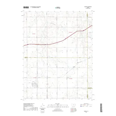
2018 Map of Waverly
USGS Topo · Published 2018About this map
The town of Waverly anchors this landscape in eastern Kansas, serving as a primary point of settlement where local roads converge near the southern edge of the survey. North of town, the terrain is defined by the drainage systems of Rock Creek and Willow Cr, which carve a series of modest valleys across the prairie. The smaller community of Agricola sits to the northeast, positioned along a transit corridor that includes the Old State Hwy 50. For genealogists and local historians, several burial grounds are documented, including Waverly Cem, Rock Creek Cem, and Pleasant View Cem. These sites, along with landmarks like Lane Hollow, provide specific points of reference for tracing family lineages and early land tracts in the region. The map also illustrates the convergence of several county lines, including the borders of Osage, Coffey, Franklin, and Anderson counties.
Find a feature on this map
68 named features on this map. Tap any name to fly to it.
Don’t see what you’re looking for? This feature index may not catch every label — zoom into the map to look around manually.
Map Details
Editions of this 2018 Waverly Map
This is the sole edition of this map. No revisions or reprints were ever made.
Other maps of this area

1885 · Burlington
USGS Topo · 1:125,000

1885 · Garnett
USGS Topo · 1:125,000

1885 · Lawrence
USGS Topo · 1:125,000

1889 · Burlingame
USGS Topo · 1:125,000

1889 · Lawrence
USGS Topo · 1:125,000

1894 · Garnett
USGS Topo · 1:125,000

1894 · Burlingame
USGS Topo · 1:125,000

1894 · Burlington
USGS Topo · 1:125,000

1947 · Lawrence
USGS Topo · 1:250,000

1950 · Lawrence
USGS Topo · 1:250,000