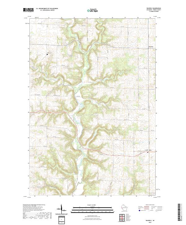
2022 Map of Waverly
USGS Topo · Published 2022About this map
Rush River carves a deep valley through this portion of Pierce County, defining a landscape of narrow ridges and branching coulees. The small settlements of Waverly and Ono anchor the rural road network, which follows the high ground between drainages like Brush Cr and Lost Cr. This topographic study reveals how local geography dictated early land use, from the placement of the Ono Methodist Cem near the town center to the Lost Creek Cem overlooking its namesake waterway. Landforms such as Bremennington Coulee and Morgan Coulee reflect the drainage patterns that feed into the river valley, while named heights like Austerland Hill RD mark the transition from the river bottom to the surrounding agricultural uplands.
Find a feature on this map
50 named features on this map. Tap any name to fly to it.
Don’t see what you’re looking for? This feature index may not catch every label — zoom into the map to look around manually.
Map Details
Editions of this 2022 Waverly Map
This is the sole edition of this map. No revisions or reprints were ever made.
Other maps of this area

1935 · Arkansaw
USGS Topo · 1:48,000

1940 · Maiden Rock
USGS Topo · 1:62,500

1941 · Arkansaw
USGS Topo · 1:62,500

1942 · Arkansaw
USGS Topo · 1:62,500

1946 · Knapp
USGS Topo · 1:62,500

1949 · Knapp
USGS Topo · 1:62,500

1949 · Baldwin
USGS Topo · 1:62,500

1950 · Maiden Rock
USGS Topo · 1:62,500

1953 · Saint Paul
USGS Topo · 1:250,000

1959 · Saint Paul
USGS Topo · 1:250,000