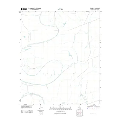
2012 Map of Waverly SE
USGS Topo · Published 2012About this map
The Tensas River meanders heavily through this portion of Madison Parish, creating a complex alluvial landscape defined by oxbow lakes and winding waterways. These former river channels are visible in features like Horseshoe Lake, Big Rainey Lake, and Little Rainey Lake, which mark the river's historic shifts across the floodplain. The area is intersected by a network of drainage systems including Mothglam Bayou, Johns Bayou, and Mack Bayou, indicating a terrain where water management is central to the land's utility.
Find a feature on this map
16 named features on this map. Tap any name to fly to it.
Don’t see what you’re looking for? This feature index may not catch every label — zoom into the map to look around manually.
Map Details
Editions of this 2012 Waverly SE Map
This is the sole edition of this map. No revisions or reprints were ever made.
Other maps of this area

1909 · Tallulah
USGS Topo · 1:24,000

1935 · Waverly
USGS Topo · 1:62,500

1935 · Shackleford Lake
USGS Topo · 1:62,500

1939 · Talla Bena
USGS Topo · 1:62,500

1955 · Jackson
USGS Topo · 1:250,000

1958 · Shackleford Lake
USGS Topo · 1:62,500

1961 · Jackson
USGS Topo · 1:250,000

1961 · Waverly
USGS Topo · 1:62,500

1962 · Jackson
USGS Topo · 1:250,000
1963 · Somerset
USGS Topo · 1:24,000