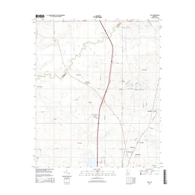
2015 Map of Way
USGS Topo · Published 2015About this map
The Big Black River snakes through the center of this landscape, defining the border between Yazoo and Madison counties. This recent survey captures the transition from the river bottomlands, such as Pisgah Bottom, to the rising elevations of Beech Ridge. For family historians, the area is rich with small burial grounds and rural congregations, including the Humble Jerusalem Missionary Baptist Church Cem, Leggitt Family Cem, and Thornton Chapel Cem. In the southeastern corner, the northern reaches of Canton begin to appear near the small settlements of Milltown and Cobbville. Oxbow formations like Horseshoe Lake and Watts Lake stand as silent witnesses to the river's shifting course over decades, while the Providence Airpark represents a modern point of navigation in this otherwise agricultural and riparian corridor.
Find a feature on this map
86 named features on this map. Tap any name to fly to it.
Don’t see what you’re looking for? This feature index may not catch every label — zoom into the map to look around manually.
Map Details
Editions of this 2015 Way Map
This is the sole edition of this map. No revisions or reprints were ever made.
Other maps of this area

1953 · Meridian
USGS Topo · 1:250,000

1955 · Jackson
USGS Topo · 1:250,000

1957 · Meridian
USGS Topo · 1:250,000

1960 · Sharon
USGS Topo · 1:62,500

1961 · Jackson
USGS Topo · 1:250,000

1961 · Canton
USGS Topo · 1:62,500

1962 · Jackson
USGS Topo · 1:250,000

1964 · Linwood
USGS Topo · 1:24,000

1964 · Vaughan
USGS Topo · 1:24,000

1965 · Meridian
USGS Topo · 1:250,000