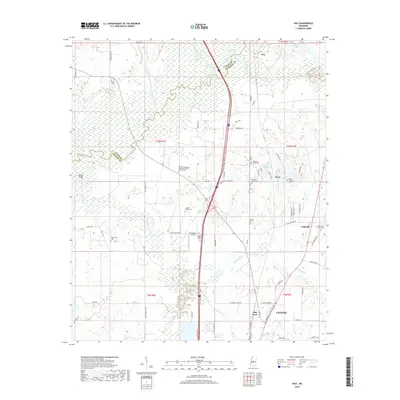
2018 Map of Way
USGS Topo · Published 2018About this map
Big Black River forms a defining natural boundary on this landscape, winding through a complex of wetlands and oxbow lakes like Horseshoe Lake and Carter Lake. The map reveals a rural transition between Madison and Yazoo counties, where the high ground of Beech Ridge contrasts with the floodplains of Tilda Bogue and Batchelor Cr. Local history is deeply etched into the land through numerous family burial sites and rural congregations, including the Leggitt Family Cem, White Family Cem, and Humble Jerusalem Missionary Baptist Church Cem. The southern edge of the survey captures the northern expansion of Canton, including the industrial and residential pockets of Mill Town. Transportation is a central theme, with the modern transit corridor of the interstate bisecting the quadrangle, while older routes like Old Yazoo City Rd and Pisgah Bottom Rd follow the older contours of the settlements at Way and Davis.
Find a feature on this map
79 named features on this map. Tap any name to fly to it.
Don’t see what you’re looking for? This feature index may not catch every label — zoom into the map to look around manually.
Map Details
Editions of this 2018 Way Map
This is the sole edition of this map. No revisions or reprints were ever made.
Other maps of this area

1953 · Meridian
USGS Topo · 1:250,000

1955 · Jackson
USGS Topo · 1:250,000

1957 · Meridian
USGS Topo · 1:250,000

1960 · Sharon
USGS Topo · 1:62,500

1961 · Jackson
USGS Topo · 1:250,000

1961 · Canton
USGS Topo · 1:62,500

1962 · Jackson
USGS Topo · 1:250,000

1964 · Linwood
USGS Topo · 1:24,000

1964 · Vaughan
USGS Topo · 1:24,000

1965 · Meridian
USGS Topo · 1:250,000