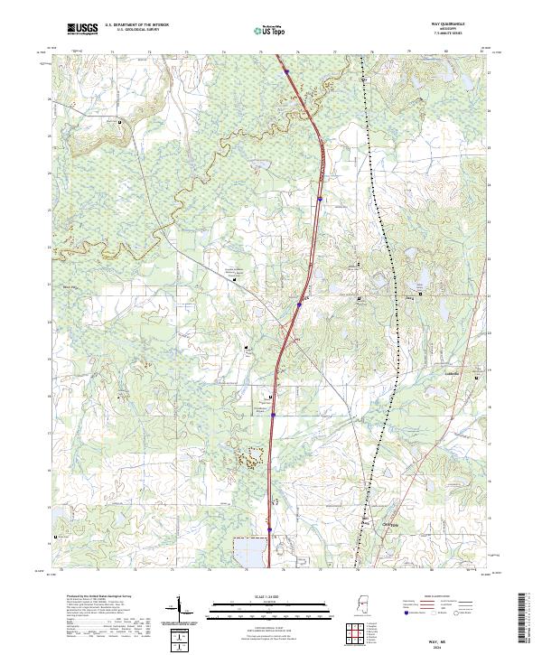
2024 Map of Way
USGS Topo · Published 2024About this map
Big Black River defines the western edge of this territory along the border of Madison and Yazoo counties, creating a landscape of oxbow lakes and wetlands like Watts Lake and Horseshoe Lake. The area is characterized by a high density of rural religious and family sites, including Humble Jerusalem Missionary Baptist Church and several distinct burial grounds such as the White Family Cem and Leggitt Family Cem.
Find a feature on this map
78 named features on this map. Tap any name to fly to it.
Don’t see what you’re looking for? This feature index may not catch every label — zoom into the map to look around manually.
Map Details
Editions of this 2024 Way Map
This is the sole edition of this map. No revisions or reprints were ever made.
Other maps of this area

1953 · Meridian
USGS Topo · 1:250,000

1955 · Jackson
USGS Topo · 1:250,000

1957 · Meridian
USGS Topo · 1:250,000

1960 · Sharon
USGS Topo · 1:62,500

1961 · Jackson
USGS Topo · 1:250,000

1961 · Canton
USGS Topo · 1:62,500

1962 · Jackson
USGS Topo · 1:250,000

1964 · Linwood
USGS Topo · 1:24,000

1964 · Vaughan
USGS Topo · 1:24,000

1965 · Meridian
USGS Topo · 1:250,000