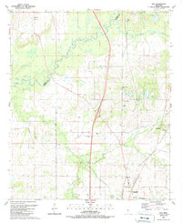
1989 Map of Way
USGS Topo · Published 1989About this map
The Big Black River carves a winding path across this landscape, defining the border between Yazoo and Madison counties. This late-twentieth-century survey reveals a rural territory marked by numerous family-named landmarks and small religious centers. The community of Way sits at the northern edge, while the southern reaches show the outskirts of Canton, including the Mill Town settlement and industrial features like the Radio Tower (WDOB).
Find a feature on this map
47 named features on this map. Tap any name to fly to it.
Don’t see what you’re looking for? This feature index may not catch every label — zoom into the map to look around manually.
Map Details
Editions of this 1989 Way Map
This is the sole edition of this map. No revisions or reprints were ever made.
Other maps of this area

1953 · Meridian
USGS Topo · 1:250,000

1955 · Jackson
USGS Topo · 1:250,000

1957 · Meridian
USGS Topo · 1:250,000

1960 · Sharon
USGS Topo · 1:62,500

1961 · Jackson
USGS Topo · 1:250,000

1961 · Canton
USGS Topo · 1:62,500

1962 · Jackson
USGS Topo · 1:250,000

1964 · Linwood
USGS Topo · 1:24,000

1964 · Vaughan
USGS Topo · 1:24,000

1965 · Meridian
USGS Topo · 1:250,000