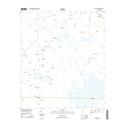
2014 Map of Waycross SE
USGS Topo · Published 2014About this map
Skullhead and Braganza anchor the upper reaches of this watery landscape where the Ware Co Charlton Co boundary divides a vast network of islands and hammocks. The terrain is characterized by a complex system of named landforms rising above the wetlands, such as Negro Camp Island, Cowhouse Island, and the curiously named Wheel of Fortune Island. Transport is restricted to perimeter routes like Swamp Perimeter Rd and Ga-177, which skirt the edges of deeper swamp features including Barbers Run and Skull Lake. This geography reflects a classic southeastern wetland environment where every minor elevation is named, from Deer Gallus Island to Seldom Seen Point. Genealogists and local historians can trace the specific boundaries of these named landmarks, which often represent historically significant family or community sites within the larger Gum Swamp and Bear Belly Strand regions.
Find a feature on this map
60 named features on this map. Tap any name to fly to it.
Don’t see what you’re looking for? This feature index may not catch every label — zoom into the map to look around manually.
Map Details
Editions of this 2014 Waycross SE Map
This is the sole edition of this map. No revisions or reprints were ever made.
Other maps of this area

1918 · Folkston
USGS Topo · 1:62,500

1953 · Waycross
USGS Topo · 1:250,000

1954 · Valdosta
USGS Topo · 1:250,000

1958 · Valdosta
USGS Topo · 1:250,000

1958 · Waycross
USGS Topo · 1:250,000

1959 · Valdosta
USGS Topo · 1:250,000

1965 · Double Lakes
USGS Topo · 1:24,000

1965 · Dinner Pond
USGS Topo · 1:24,000

1966 · Cravens Island
USGS Topo · 1:24,000

1967 · Waycross SE
USGS Topo · 1:24,000