2020 Map of Waycross SE
USGS Topo · Published 2020About this map
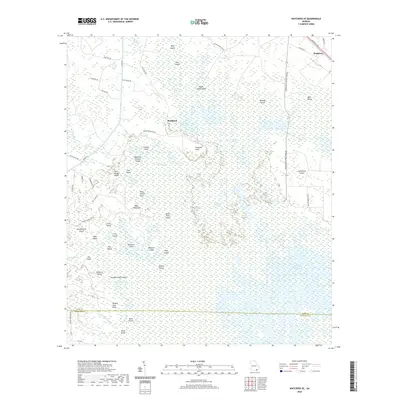
Okefenokee Swamp dominates this landscape on the edge of Ware and Charlton counties, characterized by a complex network of named islands and prairies. The interior is largely roadless, save for the Swamp Perimeter Rd and Okefenokee Swamp Park Rd, which provide access to the edge of the wilderness. Notable terrain features with evocative names like Wheel of Fortune Island, Negro Camp Island, and Seldom Seen Point indicate a history of local exploration and naming within the swamp's interior. To the northeast, the settlement of Braganza sits along Memorial Dr near the edge of the wetlands. The transition from the dense swamp to the drier upland is marked by features such as Gum Swamp and Pike Swamp, while the interior remains a vast watery mosaic of sites like Maul Hammock Lake and Sapling Prairie.
Find a feature on this map
58 named features on this map. Tap any name to fly to it.
Don’t see what you’re looking for? This feature index may not catch every label — zoom into the map to look around manually.
Map Details
Editions of this 2020 Waycross SE Map
This is the sole edition of this map. No revisions or reprints were ever made.
Other maps of this area

1918 · Folkston
USGS Topo · 1:62,500

1953 · Waycross
USGS Topo · 1:250,000

1954 · Valdosta
USGS Topo · 1:250,000

1958 · Valdosta
USGS Topo · 1:250,000

1958 · Waycross
USGS Topo · 1:250,000

1959 · Valdosta
USGS Topo · 1:250,000

1965 · Double Lakes
USGS Topo · 1:24,000

1965 · Dinner Pond
USGS Topo · 1:24,000

1966 · Cravens Island
USGS Topo · 1:24,000

1967 · Waycross SE
USGS Topo · 1:24,000