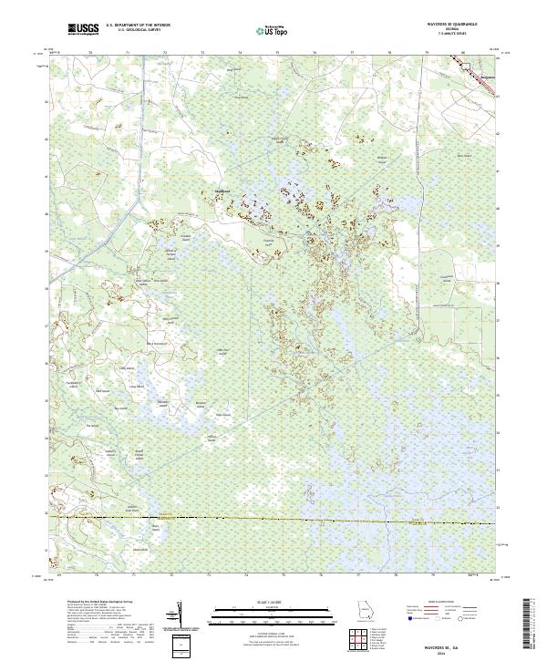
2024 Map of Waycross SE
USGS Topo · Published 2024About this map
The vast wetlands of the Okefenokee National Wildlife Refuge dominate this landscape, where the boundary between Ware and Charlton counties passes through a network of prairies and islands. Small settlements like Braganza and Skullhead sit on the periphery, connected by rural routes such as Swamp Rd and Skullhead Rd. The map reveals a labyrinth of water and land with evocatively named features like Wheel of Fortune Island, Negro Camp Island, and Seldom Seen Point. Within the Okefenokee Wilderness, open water features including Maul Hammock Lake and Sapling Prairie are interspersed with dense swamp vegetation. The presence of Bear Lake Strand and Alligator Creek underscore the primitive hydrological character of the region, while landmarks like Cowhouse Island and Black Hammock provide high-ground reference points in the marshy expanse.
Find a feature on this map
58 named features on this map. Tap any name to fly to it.
Don’t see what you’re looking for? This feature index may not catch every label — zoom into the map to look around manually.
Map Details
Editions of this 2024 Waycross SE Map
This is the sole edition of this map. No revisions or reprints were ever made.
Other maps of this area

1918 · Folkston
USGS Topo · 1:62,500

1953 · Waycross
USGS Topo · 1:250,000

1954 · Valdosta
USGS Topo · 1:250,000

1958 · Valdosta
USGS Topo · 1:250,000

1958 · Waycross
USGS Topo · 1:250,000

1959 · Valdosta
USGS Topo · 1:250,000

1965 · Double Lakes
USGS Topo · 1:24,000

1965 · Dinner Pond
USGS Topo · 1:24,000

1966 · Cravens Island
USGS Topo · 1:24,000

1967 · Waycross SE
USGS Topo · 1:24,000