
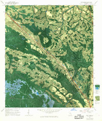
1967 Map of Waycross SE
USGS Topo · Published 1968About this map
Okefenokee Swamp dominates this landscape, where the intricate network of the Waycross State Forest meets the protected reaches of the Okefenokee National Wildlife Refuge. The map provides a detailed view of the transition from upland timber to aquatic prairie, featuring numerous named islands such as Negro Camp Island, Croaker Island, and the curiously named Wheel of Fortune Island.
Find a feature on this map
63 named features on this map. Tap any name to fly to it.
Don’t see what you’re looking for? This feature index may not catch every label — zoom into the map to look around manually.
Map Details
Editions of this 1967 Waycross SE Map
This is the sole edition of this map. No revisions or reprints were ever made.
Other maps of this area

1918 · Folkston
USGS Topo · 1:62,500

1953 · Waycross
USGS Topo · 1:250,000

1954 · Valdosta
USGS Topo · 1:250,000

1958 · Valdosta
USGS Topo · 1:250,000

1958 · Waycross
USGS Topo · 1:250,000

1959 · Valdosta
USGS Topo · 1:250,000

1965 · Double Lakes
USGS Topo · 1:24,000

1965 · Dinner Pond
USGS Topo · 1:24,000

1966 · Cravens Island
USGS Topo · 1:24,000
1967 · Fort Mudge
USGS Topo · 1:24,000