
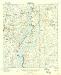
1978 Map of Waycross
USGS Topo · Published 1982About this map
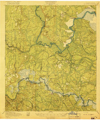
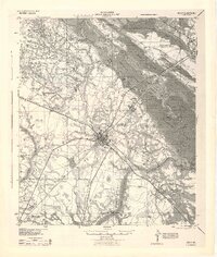
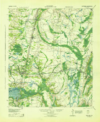
The Okefenokee Swamp and its associated wildlife refuge dominate the southeastern portion of this landscape, where a intricate network of islands and prairies like Cowhouse Island and Cowhouse Prairie define the northern reaches of the famous wetland. Centered on the railroad hub of Waycross, the map reveals a late-1970s view of south Georgia’s timber and transit corridor. The Seaboard Coast Line tracks converge here from multiple directions, connecting rural settlements such as Millwood, Waresboro, and Blackshear.
Find a feature on this map
108 named features on this map. Tap any name to fly to it.
Don’t see what you’re looking for? This feature index may not catch every label — zoom into the map to look around manually.
Map Details
Editions of this 1978 Waycross Map
This is the sole edition of this map. No revisions or reprints were ever made.
Other maps of this area
1917 · Nahunta
USGS Topo · 1:62,500

1917 · Boulogne
USGS Topo · 1:62,500
1918 · Jesup
USGS Topo · 1:62,500

1918 · Folkston
USGS Topo · 1:62,500
1918 · Hortense
USGS Topo · 1:62,500
1918 · Nahunta
USGS Topo · 1:62,500
1919 · Boulogne
USGS Topo · 1:62,500
1943 · Jesup
USGS Topo · 1:62,500
1944 · Hortense
USGS Topo · 1:62,500

1946 · Brunswick
USGS Topo · 1:250,000