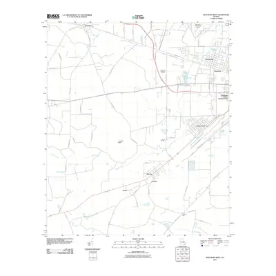
2011 Map of Waycross West
USGS Topo · Published 2011About this map
Waresboro and the western suburbs of Waycross occupy a landscape defined by the shifting course of Kettle Creek and the expansive Gum Swamp. This 2011 survey documents a transition from the denser residential development of Winona Park and Deenwood in the northeast to the more isolated agricultural communities and named locales such as Ruskin, Needham, and Wahoma to the southwest. The presence of the Waycross-Ware County Airport and the Garlington Heights Housing Project reflects the modern infrastructure serving the county seat. For genealogists, the map preserves the locations of several burial grounds, including Crestwood Memorial Gardens, Barner Cemetery, and the historic Kettle Creek Cemetery. The network of country roads, such as S Clough Bay Rd and Muscat Bay Rd, provides access to rural homesteads and unique terrain features like Lingerfelt Island.
Find a feature on this map
70 named features on this map. Tap any name to fly to it.
Don’t see what you’re looking for? This feature index may not catch every label — zoom into the map to look around manually.
Map Details
Editions of this 2011 Waycross West Map
This is the sole edition of this map. No revisions or reprints were ever made.
Other maps of this area

1953 · Waycross
USGS Topo · 1:250,000

1958 · Waycross
USGS Topo · 1:250,000

1967 · Waycross SE
USGS Topo · 1:24,000

1967 · Waycross West
USGS Topo · 1:24,000

1967 · Pine Valley
USGS Topo · 1:24,000

1967 · Waycross East
USGS Topo · 1:24,000

1967 · Waycross SW
USGS Topo · 1:24,000

1968 · Manor
USGS Topo · 1:24,000

1971 · Dixie Union
USGS Topo · 1:24,000

1971 · Talmo
USGS Topo · 1:24,000