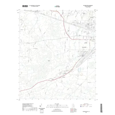
2020 Map of Waycross West
USGS Topo · Published 2020About this map
Waycross serves as a regional hub in this modern survey of Ware County, where the extensive rail infrastructure of CSX Transportation converges near the heart of the city. The landscape is characterized by a complex network of wetlands and bays typical of south Georgia, including Musket Bay and Cloughs Bay, which dominate the western portion of the quadrangle. Several established neighborhoods and outlying communities are detailed, such as Deenwood to the north and the cluster of Wahoma, Needham, and Ruskin along the rail corridor to the southwest.
Find a feature on this map
147 named features on this map. Tap any name to fly to it.
Don’t see what you’re looking for? This feature index may not catch every label — zoom into the map to look around manually.
Map Details
Editions of this 2020 Waycross West Map
This is the sole edition of this map. No revisions or reprints were ever made.
Other maps of this area

1953 · Waycross
USGS Topo · 1:250,000

1958 · Waycross
USGS Topo · 1:250,000

1967 · Waycross SE
USGS Topo · 1:24,000

1967 · Waycross West
USGS Topo · 1:24,000

1967 · Pine Valley
USGS Topo · 1:24,000

1967 · Waycross East
USGS Topo · 1:24,000

1967 · Waycross SW
USGS Topo · 1:24,000

1968 · Manor
USGS Topo · 1:24,000

1971 · Dixie Union
USGS Topo · 1:24,000

1971 · Talmo
USGS Topo · 1:24,000