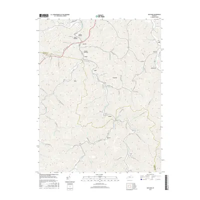
2016 Map of Wayland
USGS Topo · Published 2016About this map
Right Fork Beaver Creek carves a deep path through the coal-bearing mountains of eastern Kentucky, where tight-knit settlements like Wayland, Garrett, and Lackey follow the valley floor. The map highlights the region's industrial and family history, with specialized landmarks such as Bosco Tipple Rd and Porter Junction indicating the complex infrastructure required for local resource extraction. Numerous family burial sites, including Chafins Cem, Bradley Cem, and Gibson Cem, are scattered across the ridges and hollows, serving as vital markers for genealogists tracing ancestral homesteads in Floyd Co and Knott Co. The layout of mountain roads like S Railroad St and Millard Allen Dr reveals how the community developed around the winding rail and river networks that define the Appalachian landscape.
Find a feature on this map
86 named features on this map. Tap any name to fly to it.
Don’t see what you’re looking for? This feature index may not catch every label — zoom into the map to look around manually.
Map Details
Editions of this 2016 Wayland Map
This is the sole edition of this map. No revisions or reprints were ever made.
Other maps of this area

1886 · Prestonsburg
USGS Topo · 1:125,000

1890 · Whitesburg
USGS Topo · 1:125,000

1892 · Whitesburg
USGS Topo · 1:125,000

1892 · Prestonsburg
USGS Topo · 1:125,000

1912 · Hindman
USGS Topo · 1:48,000

1914 · Laynesville
USGS Topo · 1:48,000

1914 · Vergie
USGS Topo · 1:48,000

1915 · Prestonsburg
USGS Topo · 1:62,500

1915 · Hindman
USGS Topo · 1:62,500

1916 · Harold
USGS Topo · 1:62,500