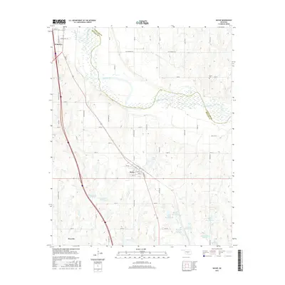
2016 Map of Wayne
USGS Topo · Published 2016About this map
Purcell and Wayne anchor this portion of the Oklahoma plains along the winding course of the Canadian River. The landscape is defined by the intersection of McClain and Cleveland counties, where a complex network of water management features indicates the agricultural and flood control priorities of the region. Numerous reservoirs, such as Finn Creek Site 36 Reservoir and a series of Owl Creek Site 1 Reservoir developments, dot the terrain alongside Rose Lake. Genealogists will find interest in the Denton Cem, situated in the northeast near the county line. The map detail reflects a transition from the structured street grids of established towns to the rural section lines of the surrounding territory, traced by roads with distinctive local names like Flat Armadillo Rd and Cotton Gin Ave.
Find a feature on this map
58 named features on this map. Tap any name to fly to it.
Don’t see what you’re looking for? This feature index may not catch every label — zoom into the map to look around manually.
Map Details
Editions of this 2016 Wayne Map
This is the sole edition of this map. No revisions or reprints were ever made.
Other maps of this area

1893 · Norman
USGS Topo · 1:62,500

1898 · Purcell
USGS Topo · 1:125,000

1898 · Pauls Valley
USGS Topo · 1:125,000

1902 · Pauls Valley
USGS Topo · 1:125,000

1910 · McComb
USGS Topo · 1:62,500

1936 · Norman
USGS Topo · 1:62,500

1954 · Oklahoma City
USGS Topo · 1:250,000

1957 · Ardmore
USGS Topo · 1:250,000

1957 · Oklahoma City
USGS Topo · 1:250,000
1958 · Eason
USGS Topo · 1:24,000