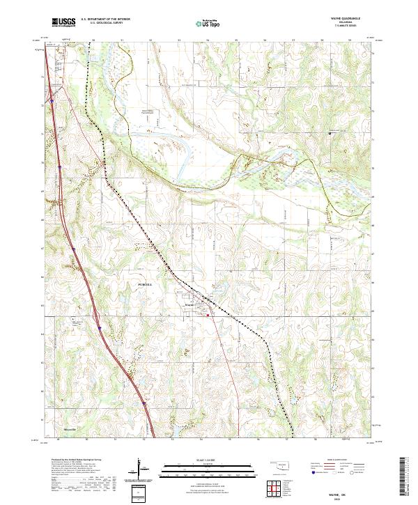
2022 Map of Wayne
USGS Topo · Published 2022About this map
The Canadian River meanders across this McClain County landscape, defining the transition between the rolling uplands and the river valley. The town of Wayne serves as a central hub, where the local street grid features historically resonant names like Cotton Gin Ave and Railway Ave, reflecting the community's agrarian and transport roots. To the north, the southern edge of Purcell enters the frame, while the Denton Cem remains a quiet landmark of local genealogy near the Cleveland Co McClain Co line.
Find a feature on this map
56 named features on this map. Tap any name to fly to it.
Don’t see what you’re looking for? This feature index may not catch every label — zoom into the map to look around manually.
Map Details
Editions of this 2022 Wayne Map
This is the sole edition of this map. No revisions or reprints were ever made.
Other maps of this area

1893 · Norman
USGS Topo · 1:62,500

1898 · Purcell
USGS Topo · 1:125,000

1898 · Pauls Valley
USGS Topo · 1:125,000

1902 · Pauls Valley
USGS Topo · 1:125,000

1910 · McComb
USGS Topo · 1:62,500

1936 · Norman
USGS Topo · 1:62,500

1954 · Oklahoma City
USGS Topo · 1:250,000

1957 · Ardmore
USGS Topo · 1:250,000

1957 · Oklahoma City
USGS Topo · 1:250,000
1958 · Eason
USGS Topo · 1:24,000