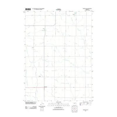
2011 Map of Wayne SW
USGS Topo · Published 2011About this map
Spurville and the surrounding agricultural lands of Stanton County define this section of Northeast Nebraska. The landscape is characterized by a precise grid of rural roads, including 848th Rd and 565th Ave, which delineate the expansive farming tracts. Water management is a central feature of the terrain, visible through the presence of the Dangberg Dam and Brogren Dam, which create the Dangberg Reservoir and Brogren Reservoir respectively. These man-made features interact with the natural drainage of Humbug Creek and its tributaries, such as the South Branch Humbug Creek, which meander through the section lines.
Find a feature on this map
32 named features on this map. Tap any name to fly to it.
Don’t see what you’re looking for? This feature index may not catch every label — zoom into the map to look around manually.
Map Details
Editions of this 2011 Wayne SW Map
This is the sole edition of this map. No revisions or reprints were ever made.
Other maps of this area

1955 · Sioux City
USGS Topo · 1:250,000

1955 · Fremont
USGS Topo · 1:250,000

1957 · Fremont
USGS Topo · 1:250,000

1958 · Sioux City
USGS Topo · 1:250,000

1958 · Fremont
USGS Topo · 1:250,000

1959 · Sioux City
USGS Topo · 1:250,000

1963 · Hoskins
USGS Topo · 1:24,000

1963 · Pilger
USGS Topo · 1:24,000

1963 · Wayne SW
USGS Topo · 1:24,000

1963 · Winside
USGS Topo · 1:24,000