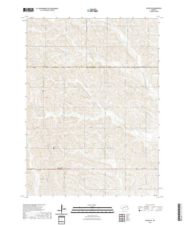
2021 Map of Wayne SW
USGS Topo · Published 2021About this map
The settlement of Spurville anchors the southern portion of this landscape where the borders of Wayne and Stanton counties meet. The terrain is defined by a dense network of intermittent drainage and creek beds, most notably the upper reaches of Humbug Cr and its southern branch, S Br Humbug Cr. Smaller waterways like Maskenthine Cr, Payne Cr, and Indian Cr carve into the upland plains, illustrating the intricate hydrology of the region. Local history is marked by established community sites, including Bethlehem Cem and Bega Cem, which serve as permanent records of the area's early residents. Agricultural water management is evident through the presence of the Dangberg Reservoir in the northeast and the Broogren Reservoir further west, both situated among a strictly ordered grid of section roads such as 848th RD and 840th RD.
Find a feature on this map
29 named features on this map. Tap any name to fly to it.
Don’t see what you’re looking for? This feature index may not catch every label — zoom into the map to look around manually.
Map Details
Editions of this 2021 Wayne SW Map
This is the sole edition of this map. No revisions or reprints were ever made.
Other maps of this area

1955 · Sioux City
USGS Topo · 1:250,000

1955 · Fremont
USGS Topo · 1:250,000

1957 · Fremont
USGS Topo · 1:250,000

1958 · Sioux City
USGS Topo · 1:250,000

1958 · Fremont
USGS Topo · 1:250,000

1959 · Sioux City
USGS Topo · 1:250,000

1963 · Hoskins
USGS Topo · 1:24,000

1963 · Pilger
USGS Topo · 1:24,000

1963 · Wayne SW
USGS Topo · 1:24,000

1963 · Winside
USGS Topo · 1:24,000