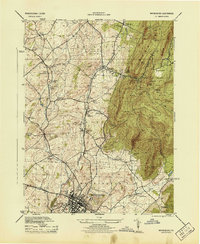
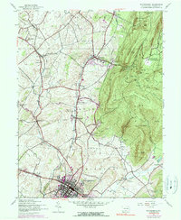
1944 Map of Waynesboro
USGS Topo · Published 1944About this map
Waynesboro anchors this 1944 survey, situated at the junction of the Western Maryland and Pennsylvania railroads. The map reveals a landscape defined by the transition from the industrial and agricultural valley floor to the forested slopes of South Mountain. A significant portion of the mountain terrain is occupied by the Mont Alto Sanatorium Grounds and the Pennsylvania State Forest School, reflecting the era's focus on public health and natural resource management. Along the valley, numerous small settlements and sidings like Quinsonia Siding, Altenwald, and Knepper illustrate the historic rail-dependent economy of Franklin County. The drainage patterns of Antietam Creek are clearly delineated, showing the West Branch and East Branch converging near the town center, while landmarks such as the Waynesboro Country Club and the Armory mark the suburban edges of the growing borough.
Find a feature on this map
71 named features on this map. Tap any name to fly to it.
Don’t see what you’re looking for? This feature index may not catch every label — zoom into the map to look around manually.
Map Details
Editions of this 1944 Waynesboro Map
5 editions found
Other maps of this area

1902 · Chambersburg
USGS Topo · 1:62,500

1909 · Fairfield
USGS Topo · 1:62,500

1909 · Hagerstown
USGS Topo · 1:48,000

1911 · Emmitsburg
USGS Topo · 1:62,500

1912 · Hagerstown
USGS Topo · 1:62,500

1942 · Hagerstown
USGS Topo · 1:125,000

1942 · Gettysburg
USGS Topo · 1:125,000

1943 · Emmitsburg
USGS Topo · 1:62,500

1943 · Hagerstown
USGS Topo · 1:125,000

1943 · Chambersburg
USGS Topo · 1:62,500