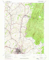
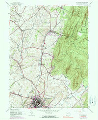
1944 Map of Waynesboro
USGS Topo · Published 1974About this map
Waynesboro serves as the industrial and social anchor of this Franklin County landscape, set against the steep western slopes of South Mountain. The map illustrates a dense network of rural infrastructure, where numerous small schools like Ryder Sch and Pigeon Hills Sch supported a community organized into the townships of Guilford, Quincy, and Washington. The presence of the South Mountain State Sanatorium on the high ridges above Mont Alto reflects the era's reliance on mountain air for health recovery, while the Waynesboro Reservoir tucked into the hills secured the growing town's water supply.
Find a feature on this map
67 named features on this map. Tap any name to fly to it.
Don’t see what you’re looking for? This feature index may not catch every label — zoom into the map to look around manually.
Map Details
Editions of this 1944 Waynesboro Map
5 editions found
Other maps of this area

1902 · Chambersburg
USGS Topo · 1:62,500

1909 · Fairfield
USGS Topo · 1:62,500

1909 · Hagerstown
USGS Topo · 1:48,000

1911 · Emmitsburg
USGS Topo · 1:62,500

1912 · Hagerstown
USGS Topo · 1:62,500

1942 · Hagerstown
USGS Topo · 1:125,000

1942 · Gettysburg
USGS Topo · 1:125,000

1943 · Emmitsburg
USGS Topo · 1:62,500

1943 · Hagerstown
USGS Topo · 1:125,000

1943 · Chambersburg
USGS Topo · 1:62,500