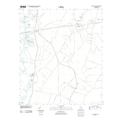
2011 Map of Waynesville
USGS Topo · Published 2011About this map
The Satilla River meanders through this portion of Georgia, defining the landscape with its series of bluffs and oxbow lakes. Settlements such as Atkinson and Waynesville serve as local hubs, connected by a network of rural roads like Thornton Rd and Old Post Rd. The geography along the river is marked by distinctive elevation points including Honey Bluff, Abrams Bluff, and Flanders Shady Bluff, while the low-lying eastern portion contains the Hayner Swamp.
Find a feature on this map
73 named features on this map. Tap any name to fly to it.
Don’t see what you’re looking for? This feature index may not catch every label — zoom into the map to look around manually.
Map Details
Editions of this 2011 Waynesville Map
This is the sole edition of this map. No revisions or reprints were ever made.
Other maps of this area

1917 · Nahunta
USGS Topo · 1:62,500

1918 · Hortense
USGS Topo · 1:62,500

1918 · Everett City
USGS Topo · 1:62,500

1918 · Nahunta
USGS Topo · 1:62,500

1918 · Bladen
USGS Topo · 1:62,500

1920 · Everett City
USGS Topo · 1:62,500

1939 · Bladen
USGS Topo · 1:62,500

1944 · Everett City
USGS Topo · 1:62,500

1944 · Hortense
USGS Topo · 1:62,500

1946 · Brunswick
USGS Topo · 1:250,000