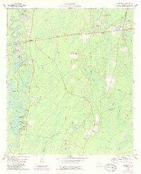
1975 Map of Waynesville
USGS Topo · Published 1987About this map
The winding course of the Satilla River dominates this mid-1970s landscape, weaving through a dense network of oxbow lakes and backwaters such as Honey Bluff, Abrahams Lake, and Atkinson Lake. The settlement at Waynesville and the rail stop at Atkinson serve as the primary hubs, connected by the CSX rail line and a series of rural roads. The area is characterized by low-lying wetlands like Knights Swamp and Seals Bay, which shaped the early development patterns of this region.
Find a feature on this map
52 named features on this map. Tap any name to fly to it.
Don’t see what you’re looking for? This feature index may not catch every label — zoom into the map to look around manually.
Map Details
Editions of this 1975 Waynesville Map
This is the sole edition of this map. No revisions or reprints were ever made.
Other maps of this area

1917 · Nahunta
USGS Topo · 1:62,500

1918 · Hortense
USGS Topo · 1:62,500

1918 · Everett City
USGS Topo · 1:62,500

1918 · Nahunta
USGS Topo · 1:62,500

1918 · Bladen
USGS Topo · 1:62,500

1920 · Everett City
USGS Topo · 1:62,500

1939 · Bladen
USGS Topo · 1:62,500

1944 · Everett City
USGS Topo · 1:62,500

1944 · Hortense
USGS Topo · 1:62,500

1946 · Brunswick
USGS Topo · 1:250,000