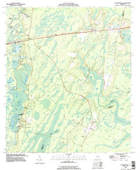
1993 Map of Waynesville
USGS Topo · Published 1995About this map
The Satilla River defines the western reaches of this landscape, its winding course giving rise to numerous oxbow lakes such as Abrahams Lake, Atkinson Lake, and Julia Lake. This coastal plain environment is characterized by extensive wetlands, including Bradley Swamp and Knights Swamp, which separate the small settlements of Atkinson and Waynesville. The presence of several family-named burial grounds like Wiggins Cem and Highsmith Cem offers significant value for genealogical research in this part of Brantley County.
Find a feature on this map
47 named features on this map. Tap any name to fly to it.
Don’t see what you’re looking for? This feature index may not catch every label — zoom into the map to look around manually.
Map Details
Editions of this 1993 Waynesville Map
This is the sole edition of this map. No revisions or reprints were ever made.
Other maps of this area

1917 · Nahunta
USGS Topo · 1:62,500

1918 · Hortense
USGS Topo · 1:62,500

1918 · Everett City
USGS Topo · 1:62,500

1918 · Nahunta
USGS Topo · 1:62,500

1918 · Bladen
USGS Topo · 1:62,500

1920 · Everett City
USGS Topo · 1:62,500

1939 · Bladen
USGS Topo · 1:62,500

1944 · Everett City
USGS Topo · 1:62,500

1944 · Hortense
USGS Topo · 1:62,500

1946 · Brunswick
USGS Topo · 1:250,000