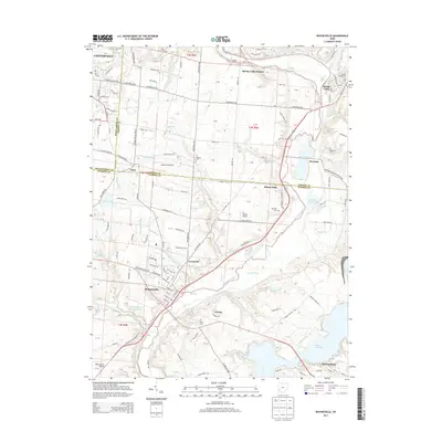
2013 Map of Waynesville
USGS Topo · Published 2013About this map
Waynesville and the winding course of the Little Miami River dominate this landscape, illustrating the historical development patterns where Warren, Greene, and Montgomery counties converge. The village of Waynesville sits as a central hub, surrounded by smaller settlements like Corwin, Crosswick, and Harveysburg to the southeast. The map reveals a dense network of local roads and family-named landmarks, including the Miami Cem and Roxanna Cem, which serve as vital markers for genealogical research in this part of Ohio.
Find a feature on this map
111 named features on this map. Tap any name to fly to it.
Don’t see what you’re looking for? This feature index may not catch every label — zoom into the map to look around manually.
Map Details
Editions of this 2013 Waynesville Map
This is the sole edition of this map. No revisions or reprints were ever made.
Other maps of this area

1907 · Blanchester
USGS Topo · 1:62,500

1913 · Waynesville
USGS Topo · 1:62,500

1914 · Morrow
USGS Topo · 1:62,500

1915 · Waynesville
USGS Topo · 1:62,500

1916 · Morrow
USGS Topo · 1:62,500

1917 · Xenia
USGS Topo · 1:62,500

1947 · Columbus
USGS Topo · 1:250,000

1953 · Cincinnati
USGS Topo · 1:250,000

1955 · New Burlington
USGS Topo · 1:24,000
1955 · Lebanon
USGS Topo · 1:24,000