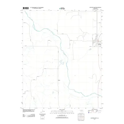
2012 Map of Waynoka West
USGS Topo · Published 2012About this map
The Cimarron River winds diagonally through this landscape, defining the character of western Woods County. On the eastern bank, the town of Waynoka serves as the primary population center, showing a grid of residential and commercial streets including Broadway St and Cedar Ave. To the west of the river, the terrain is shaped by a network of drainage systems like Sand Cr, Dog Cr, and Main Cr. The small settlement of Heman is located centrally along a north-south section line road, marking a distinct point in the rural grid.
Find a feature on this map
38 named features on this map. Tap any name to fly to it.
Don’t see what you’re looking for? This feature index may not catch every label — zoom into the map to look around manually.
Map Details
Editions of this 2012 Waynoka West Map
This is the sole edition of this map. No revisions or reprints were ever made.
Other maps of this area

1955 · Woodward
USGS Topo · 1:250,000

1958 · Woodward
USGS Topo · 1:250,000

1969 · Belva
USGS Topo · 1:24,000

1969 · Quinlan
USGS Topo · 1:24,000

1969 · Waynoka NW
USGS Topo · 1:24,000

1969 · Avard
USGS Topo · 1:24,000

1969 · Waynoka East
USGS Topo · 1:24,000

1969 · Togo
USGS Topo · 1:24,000

1969 · Waynoka West
USGS Topo · 1:24,000

1970 · Fairvalley SE
USGS Topo · 1:24,000