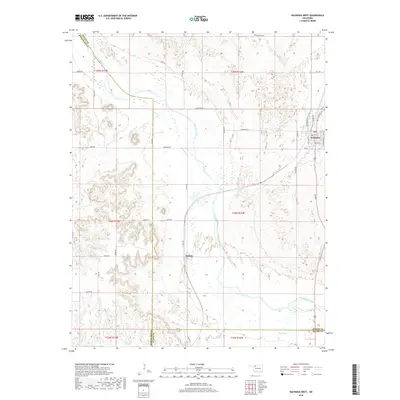
2018 Map of Waynoka West
USGS Topo · Published 2018About this map
Waynoka serves as the primary population center in this northwestern Oklahoma landscape, situated where the high plains transition into the canyon-cut terrain of the Cimarron River valley. The river dominates the geography, carving a wide path that dictates the local road network and the placement of the settlement at Heman further downstream. The survey reveals a complex system of drainage and erosion, where Sand Cr and Dog Cr feed into the Cimarron, creating distinctive topography marked by numerous small plateaus and ridges. The map illustrates a meticulously gridded infrastructure of rural routes such as Coal Rd and Cleveland Rd, which negotiate the breaks and sand hills. This environment reflects the intersection of cattle-country ranching and the strategic importance of the river corridor for early transit routes and local township development at the edge of the Cimarron valley.
Find a feature on this map
44 named features on this map. Tap any name to fly to it.
Don’t see what you’re looking for? This feature index may not catch every label — zoom into the map to look around manually.
Map Details
Editions of this 2018 Waynoka West Map
This is the sole edition of this map. No revisions or reprints were ever made.
Other maps of this area

1955 · Woodward
USGS Topo · 1:250,000

1958 · Woodward
USGS Topo · 1:250,000

1969 · Belva
USGS Topo · 1:24,000

1969 · Quinlan
USGS Topo · 1:24,000

1969 · Waynoka NW
USGS Topo · 1:24,000

1969 · Avard
USGS Topo · 1:24,000

1969 · Waynoka East
USGS Topo · 1:24,000

1969 · Togo
USGS Topo · 1:24,000

1969 · Waynoka West
USGS Topo · 1:24,000

1970 · Fairvalley SE
USGS Topo · 1:24,000