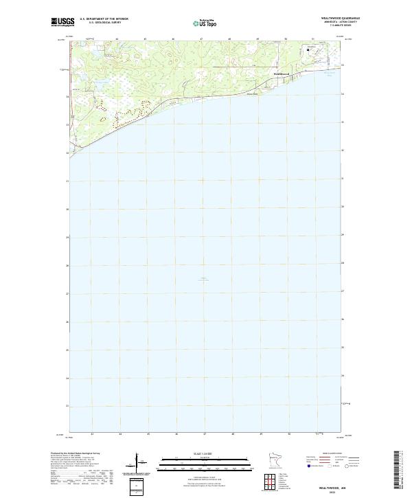
2022 Map of Wealthwood
USGS Topo · Published 2022About this map
The settlement of Wealthwood occupies the northern shoreline of Mille Lacs Lake in this modern topographic study, where the landscape transitions from the open waters of Bergstrom Bay to a complex network of wetlands and small interior basins. The northern reach of the quadrangle is defined by scattered water bodies, including Petes Lakes and Gregg Lake, which reflect the glacial hydrology of Aitkin County. Local infrastructure is concentrated along the lakefront, where roads like 240th St and 385th Ave serve the lakeside community.
Find a feature on this map
24 named features on this map. Tap any name to fly to it.
Don’t see what you’re looking for? This feature index may not catch every label — zoom into the map to look around manually.
Map Details
Editions of this 2022 Wealthwood Map
This is the sole edition of this map. No revisions or reprints were ever made.
Other maps of this area

1912 · Deerwood
USGS Topo · 1:62,500

1914 · Deerwood
USGS Topo · 1:62,500

1916 · Wealthwood
USGS Topo · 1:62,500

1953 · Duluth
USGS Topo · 1:250,000

1958 · Duluth
USGS Topo · 1:250,000

1968 · Onamia NW
USGS Topo · 1:24,000

1968 · Wahkon North
USGS Topo · 1:24,000
1968 · Vineland
USGS Topo · 1:24,000
1973 · Glen
USGS Topo · 1:24,000
1973 · Malmo
USGS Topo · 1:24,000