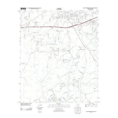
2012 Map of Weatherford South
USGS Topo · Published 2012About this map
Weatherford College anchors the northern portion of this landscape, marking the southward expansion of the Parker County seat during the early 20th century. The terrain is defined by the branching tributaries of Sanchez Creek and Threemile Branch, where the rural character of central Texas meets modern infrastructure. To the south, the small communities of Bethel and Harmony persist as local landmarks, with their history preserved in sites like Harmony Cemetery.
Find a feature on this map
173 named features on this map. Tap any name to fly to it.
Don’t see what you’re looking for? This feature index may not catch every label — zoom into the map to look around manually.
Map Details
Editions of this 2012 Weatherford South Map
This is the sole edition of this map. No revisions or reprints were ever made.
Other maps of this area

1891 · Weatherford
USGS Topo · 1:125,000

1893 · Weatherford
USGS Topo · 1:125,000

1924 · Weatherford 3-d
USGS Topo · 1:48,000

1931 · Dennis
USGS Topo · 1:62,500

1932 · Springtown
USGS Topo · 1:62,500

1954 · Dallas
USGS Topo · 1:250,000

1958 · Dallas
USGS Topo · 1:250,000
1958 · Chapin
USGS Topo · 1:24,000
1959 · Lake Weatherford
USGS Topo · 1:24,000
1959 · Tin Top
USGS Topo · 1:24,000