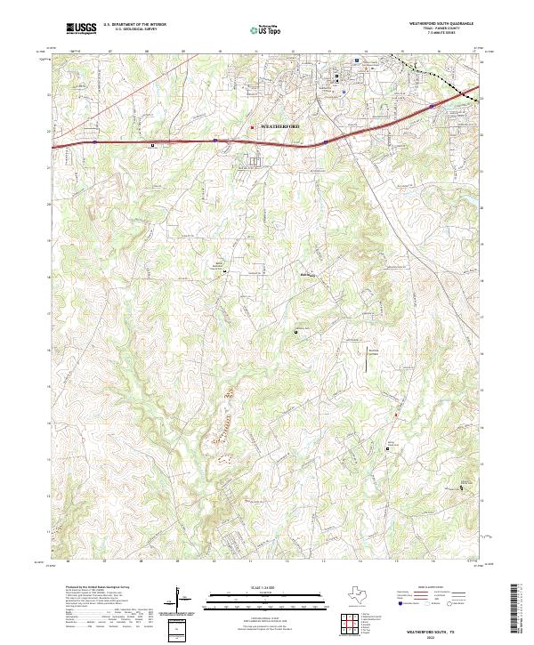
2022 Map of Weatherford South
USGS Topo · Published 2022About this map
The northern edge of this Parker County sheet is anchored by Weatherford, where the Parker County Courthouse Annex and Weatherford College serve as central landmarks. Moving south from the city, the landscape transitions into a network of creeks and small family cemeteries that testify to the long-standing settlement of the rural corridor between the city and the community of Harmony. Tributaries like Sanchez Cr, Threemile Br, and Spring Cr carve through the terrain, defining the local topography and traditional property boundaries.
Find a feature on this map
153 named features on this map. Tap any name to fly to it.
Don’t see what you’re looking for? This feature index may not catch every label — zoom into the map to look around manually.
Map Details
Editions of this 2022 Weatherford South Map
This is the sole edition of this map. No revisions or reprints were ever made.
Other maps of this area

1891 · Weatherford
USGS Topo · 1:125,000

1893 · Weatherford
USGS Topo · 1:125,000

1924 · Weatherford 3-d
USGS Topo · 1:48,000

1931 · Dennis
USGS Topo · 1:62,500

1932 · Springtown
USGS Topo · 1:62,500

1954 · Dallas
USGS Topo · 1:250,000

1958 · Dallas
USGS Topo · 1:250,000
1958 · Chapin
USGS Topo · 1:24,000
1959 · Lake Weatherford
USGS Topo · 1:24,000
1959 · Tin Top
USGS Topo · 1:24,000