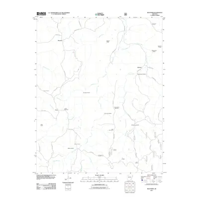
2011 Map of Weathers
USGS Topo · Published 2011About this map
Kings River carves a deep path through this Madison County landscape, where the rural settlements of Reynolds, Venus, and Weathers are connected by a network of winding local routes. The area is notable for its high concentration of family and community burial grounds, including the Mount Olive Cemetery in the north and Bethel Cemetery to the south. The topography is defined by significant elevations such as Venus Mountain, Penitentiary Mountain, and Allen Knob, alongside numerous hollows that drain into Gusses Creek and Felkins Creek. For genealogists, the map provides precise locations for the Eagle Gap Cemetery, Dripping Springs Cemetery, and Williams Cemetery, scattered among the drainages of Mitchell Branch and Mink Creek. This 2011 survey documents the persistent rural character of the region, where named landmarks like Cowcumber Hollow and Stone Jar Hollow reflect long-standing local nomenclature.
Find a feature on this map
47 named features on this map. Tap any name to fly to it.
Don’t see what you’re looking for? This feature index may not catch every label — zoom into the map to look around manually.
Map Details
Editions of this 2011 Weathers Map
This is the sole edition of this map. No revisions or reprints were ever made.
Other maps of this area

1900 · Eureka Springs
USGS Topo · 1:125,000

1901 · Eureka Springs
USGS Topo · 1:125,000

1904 · Harrison
USGS Topo · 1:125,000

1905 · Harrison
USGS Topo · 1:125,000

1945 · Harrison
USGS Topo · 1:250,000

1949 · Harrison
USGS Topo · 1:250,000

1954 · Harrison
USGS Topo · 1:250,000

1956 · Russellville
USGS Topo · 1:250,000

1958 · Harrison
USGS Topo · 1:250,000

1964 · Russellville
USGS Topo · 1:250,000