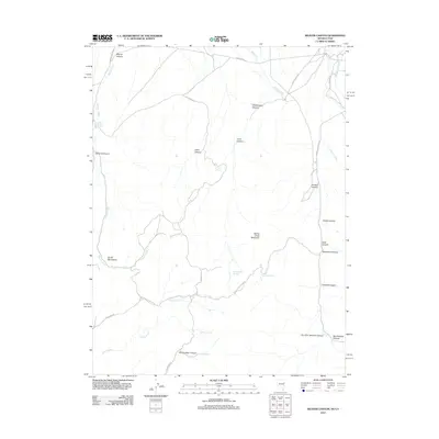
2012 Map of Weaver Canyon
USGS Topo · Published 2012About this map
Spring Creek Mountain anchors this rugged section of the Nevada-Utah border, where the high desert landscape is defined by deep drainages and intermittent water sources. The map reveals a complex network of canyons and family-named landmarks, such as Felt Robison Canyon and Big Erickson Canyon, suggesting a history of seasonal grazing and ranching. Life in this arid corridor depends on vital points like Lower Sanford Spring, Crow Spring, and Studhorse Springs scattered among the South Mountains. Transportation is limited to functional routes such as Whiskey Rd and Rye Grass Rd, which follow the natural contours of the terrain. The presence of Weaver Creek and Fifteenmile Creek highlights the drainage patterns that have carved out notable landforms like Chokecherry Canyon and Jumbo Canyon.
Find a feature on this map
35 named features on this map. Tap any name to fly to it.
Don’t see what you’re looking for? This feature index may not catch every label — zoom into the map to look around manually.
Map Details
Editions of this 2012 Weaver Canyon Map
This is the sole edition of this map. No revisions or reprints were ever made.
Other maps of this area

1908 · Fish Springs
USGS Topo · 1:250,000

1910 · Fish Springs
USGS Topo · 1:250,000

1953 · Delta
USGS Topo · 1:250,000

1956 · Ely
USGS Topo · 1:250,000

1958 · Delta
USGS Topo · 1:250,000

1959 · Ely
USGS Topo · 1:250,000

1961 · Trout Creek
USGS Topo · 1:62,500

1962 · Delta
USGS Topo · 1:250,000

1963 · Ely
USGS Topo · 1:250,000
1972 · Ibapah Peak
USGS Topo · 1:24,000