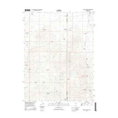
2014 Map of Weaver Canyon
USGS Topo · Published 2014About this map
The high-desert terrain of the South Mountains straddles the Great Basin border between Nevada and Utah in this 2014 survey. This landscape is defined by a series of deep canyons and seasonal water sources, including Lower Sanford Spring and Chokecherry Springs, which historically served as vital points for travelers and livestock in an otherwise arid region. The eastern edge of the quadrangle is marked by the steep rise of Spring Creek Mtn, while the drainage of Weaver Cr carves through the namesake Weaver Canyon to the northwest.
Find a feature on this map
49 named features on this map. Tap any name to fly to it.
Don’t see what you’re looking for? This feature index may not catch every label — zoom into the map to look around manually.
Map Details
Editions of this 2014 Weaver Canyon Map
This is the sole edition of this map. No revisions or reprints were ever made.
Other maps of this area

1908 · Fish Springs
USGS Topo · 1:250,000

1910 · Fish Springs
USGS Topo · 1:250,000

1953 · Delta
USGS Topo · 1:250,000

1956 · Ely
USGS Topo · 1:250,000

1958 · Delta
USGS Topo · 1:250,000

1959 · Ely
USGS Topo · 1:250,000

1961 · Trout Creek
USGS Topo · 1:62,500

1962 · Delta
USGS Topo · 1:250,000

1963 · Ely
USGS Topo · 1:250,000
1972 · Ibapah Peak
USGS Topo · 1:24,000