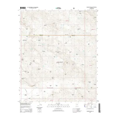
2014 Map of Weavers Needle
USGS Topo · Published 2014About this map
Weavers Needle and the iconic rock formations of the Superstition Mountains dominate this survey within the Tonto National Forest. The landscape is a complex network of arid canyons and high-elevation basins, where water is the primary point of interest for those navigating the backcountry. Numerous named water sources, such as Miller Tunnel Number One Spring and Charlebois Spring, indicate the vital role these locations played in early prospecting and travel. The terrain transitions from the edges of Gold Canyon in the southwest up toward high-relief landmarks like Miners Needle and the Dacite Cliffs.
Find a feature on this map
96 named features on this map. Tap any name to fly to it.
Don’t see what you’re looking for? This feature index may not catch every label — zoom into the map to look around manually.
Map Details
Editions of this 2014 Weavers Needle Map
This is the sole edition of this map. No revisions or reprints were ever made.
Other maps of this area

1900 · Florence
USGS Topo · 1:125,000

1902 · Florence
USGS Topo · 1:125,000

1907 · Roosevelt
USGS Topo · 1:125,000

1909 · Four Peaks
USGS Topo · 1:125,000

1912 · Roosevelt
USGS Topo · 1:125,000

1948 · Superior
USGS Topo · 1:62,500

1948 · Iron Mountain
USGS Topo · 1:24,000

1948 · Picketpost Mtn
USGS Topo · 1:24,000

1949 · Iron Mountain
USGS Topo · 1:24,000

1949 · Picketpost Mtn
USGS Topo · 1:24,000