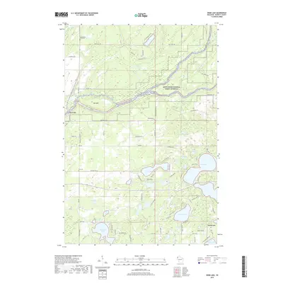
2019 Map of Webb Lake
USGS Topo · Published 2019About this map
The Saint Croix River forms a dominant natural boundary in this northern Wisconsin landscape, carving a path through the Saint Croix National Scenic Riverway. Near its banks, the settlement of Riverside sits at the junction of several forest trails and roads, while Big Island marks a significant split in the river's channel. The area is defined by a high density of kettle lakes, a common glacial legacy, ranging from the large Big Bear Lake and Webb Lake to smaller named bodies like Dogtown Lake and the numerically named Twentysix Lake.
Find a feature on this map
82 named features on this map. Tap any name to fly to it.
Don’t see what you’re looking for? This feature index may not catch every label — zoom into the map to look around manually.
Map Details
Editions of this 2019 Webb Lake Map
This is the sole edition of this map. No revisions or reprints were ever made.
Other maps of this area

1949 · Danbury
USGS Topo · 1:48,000

1949 · Hertel
USGS Topo · 1:48,000

1949 · Webb Lake
USGS Topo · 1:48,000

1950 · Webster
USGS Topo · 1:48,000

1953 · Duluth
USGS Topo · 1:250,000

1953 · Stillwater
USGS Topo · 1:250,000

1955 · Hertel
USGS Topo · 1:62,500

1955 · Webb Lake
USGS Topo · 1:62,500

1955 · Webster
USGS Topo · 1:62,500

1955 · Stillwater
USGS Topo · 1:250,000