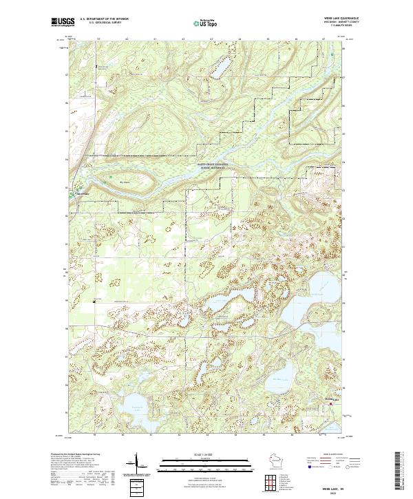
2022 Map of Webb Lake
USGS Topo · Published 2022About this map
The Saint Croix National Scenic Riverway dominates the northern reaches of this Wisconsin landscape, where the river bends around Big Island and the high ground of Big Hill. This area of Burnett County is defined by a dense network of glacial lakes and wetlands, connected by small waterways like Perkins Cr and Webb Creek. Local history is anchored by the small settlement of Riverside on the western edge and historic burial sites such as Swiss Cem and the Hillcrest Cem Association. The map reveals a transition from the protected river corridor to the lake-studded interior, where prominent water bodies like Webb Lake, Twentysix Lake, and Des Moines Lake provided the foundation for local recreation and early settlement patterns. A complex system of trails, including the Saint Croix Trl and Snowmobile Trl, underscores the region's modern reliance on seasonal tourism and conservation.
Find a feature on this map
88 named features on this map. Tap any name to fly to it.
Don’t see what you’re looking for? This feature index may not catch every label — zoom into the map to look around manually.
Map Details
Editions of this 2022 Webb Lake Map
This is the sole edition of this map. No revisions or reprints were ever made.
Other maps of this area

1949 · Danbury
USGS Topo · 1:48,000

1949 · Hertel
USGS Topo · 1:48,000

1949 · Webb Lake
USGS Topo · 1:48,000

1950 · Webster
USGS Topo · 1:48,000

1953 · Duluth
USGS Topo · 1:250,000

1953 · Stillwater
USGS Topo · 1:250,000

1955 · Hertel
USGS Topo · 1:62,500

1955 · Webb Lake
USGS Topo · 1:62,500

1955 · Webster
USGS Topo · 1:62,500

1955 · Stillwater
USGS Topo · 1:250,000