
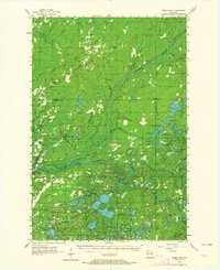
1955 Map of Webb Lake
USGS Topo · Published 1957About this map
The ST Croix River and Namekagon River converge in this mid-century landscape, a region defined by its dense network of glacial lakes and small rural settlements. Small communities like Dairyland and Cozy Corner serve as anchors for the surrounding timber and recreational lands. The presence of the Dairyland Lookout Tower and Fivemile Lookout Tower highlights the era's focus on fire surveillance across the expansive woodlands of Burnett and Douglas counties.
Find a feature on this map
84 named features on this map. Tap any name to fly to it.
Don’t see what you’re looking for? This feature index may not catch every label — zoom into the map to look around manually.
Map Details
Editions of this 1955 Webb Lake Map
2 editions found
Other maps of this area

1945 · Solon Springs
USGS Topo · 1:48,000

1947 · Minong
USGS Topo · 1:48,000

1948 · Spooner
USGS Topo · 1:48,000

1949 · Danbury
USGS Topo · 1:48,000

1949 · Solon Springs
USGS Topo · 1:48,000

1949 · Hertel
USGS Topo · 1:48,000

1949 · Holyoke
USGS Topo · 1:48,000

1949 · Minong
USGS Topo · 1:48,000

1949 · Webb Lake
USGS Topo · 1:48,000

1949 · Patzau
USGS Topo · 1:48,000