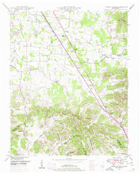
1949 Map of Webbs Jungle
USGS Topo · Published 1975About this map
The Middle Fork Stones River carves a path through this mid-century landscape, where rural life is centered around scattered settlements like Big Springs and Gum. The terrain transitions from open valleys to the prominent Tennessee Divide, which separates the northern drainage from the Woodfin Valley and Happy Valley in the south. The presence of the Dixie Highway West alongside the river indicates a significant historical transportation corridor before the modern interstate system matured.
Find a feature on this map
73 named features on this map. Tap any name to fly to it.
Don’t see what you’re looking for? This feature index may not catch every label — zoom into the map to look around manually.
Map Details
Editions of this 1949 Webbs Jungle Map
3 editions found
Other maps of this area

1908 · Woodbury
USGS Topo · 1:62,500

1913 · Hollow Springs
USGS Topo · 1:62,500

1916 · Murfreesboro
USGS Topo · 1:62,500

1936 · Webbs Jungle
USGS Topo · 1:24,000

1936 · Deason
USGS Topo · 1:24,000

1936 · Beech Grove
USGS Topo · 1:24,000

1936 · Noah
USGS Topo · 1:24,000

1936 · Wartrace
USGS Topo · 1:24,000

1936 · Fosterville
USGS Topo · 1:24,000

1942 · Statesville
USGS Topo · 1:100,000